

The 2014 Alan M. and Nathalie Voorhees Lecture on the History of Cartography will be held at the Library of Virginia on Saturday, 12 April. This year’s lecture features two guest speakers: Dr. Maury Klein, “Railroad Maps as Promises of the Future,” and William C. Wooldridge, “Tracks on Maps: Showcasing Virginia’s 19th Century Railroads.” This event includes a special one-day exhibition of maps relating to the talks from 10:00 AM to 4:00 PM. Out of the Box presents a sneak preview of two of the maps from the Library’s collection that will be on display.

Map and Profile of the Virginia and Tennessee Railroad, 1856.
Call number 755 R15 1856, Map Collection, Library of Virginia.
Railroad construction boomed in 1850s Virginia. Railroad companies drafted and published maps to raise support for and to alert the public about ongoing railroad track construction. One example is the Map and Profile of the Virginia and Tennessee Railroad. This shows the railroad track from Lynchburg to Bristol, Virginia, and highlights the technical surveys of the project in tables printed below the map. Coalfields and coal pits are shown.
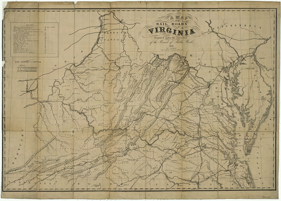
In 1858, A Map of the Rail Roads of Virginia by Ludwig von Buchholtz was lithographed by Ritchie and Dunnavant, a Richmond publishing firm. The map clearly shows the railroad lines completed in the commonwealth, those in progress, and those proposed. When compared to the 1848 Internal Improvements Map of Virginia drawn by Claudius Crozet it clearly shows that Virginia witnessed a boom in railroad construction in the 1850s.
The annual Voorhees Lecture is presented by the Fry-Jefferson Map Society whose mission is to develop, enhance, and promote the cartographic collections of the Library of Virginia. Alan M. Voorhees was a distinguished engineer and transportation consultant who planned most of the metropolitan and local transportation systems built in the free world in the 1960s and 1970s.

A Map of the rail roads of Virginia, by Lewis von Buchholtz, 1858.
Board of Public Works (BPW 672), Map Collection, Library of Virginia.
A collector of maps since the 1970s, Voorhees made his collection available for research by placing maps, charts, and atlases at the Library of Virginia, the Virginia Historical Society, the Library of Congress, and other institutions. In 1998 and 2003 Voorhees donated to the Library of Virginia maps that focus on the exploration of the Chesapeake Bay area and the development of Virginia within the context of both European and American history. It was a major contribution to the Library’s core collection of more than 12,000 historical maps. For more information on the Voorhees Lecture please call 804-692-3561. Click here to join the Fry-Jefferson Map Society.
– Cassandra Britt Farrell, Map Specialist and Senior Reference Archivist


